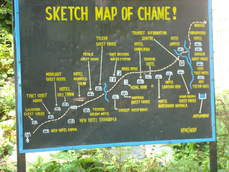
Sketch map of Chame village
Dublin Core
Title
Sketch map of Chame village
Subject
Structure
Description
Sketch map of Chame village of Gyalsumdo, Manang, Nepal. Research in Manang supported by NSF BCS 1149639 "Documenting the Languages of Manang, Nepal for Local & International Impact"
Creator
Kristine Hildebrandt
Publisher
Manang Languages Project https://mananglanguages.isg.siue.edu/
Date
2007
Contributor
Sujata Bista
Rights
Attribution-NonCommercial 4.0 International https://creativecommons.org/licenses/by-nc/4.0/
Format
jpg
Coverage
Chame, Manang, Nepal
Still Image Item Type Metadata
Original Format
jpg
Physical Dimensions
3264x2448
Collection:
Gyalsumdo images
Tags
Citation
Kristine Hildebrandt, “Sketch map of Chame village,” Manang Languages Archive, accessed January 30, 2026, https://iris.siue.edu/manang-languages-archive/items/show/1018.
